
TRIP STATS
Mountain(s): Pyramid Peak (14,029')
Distance: 8.2 miles
Elevation Gain: 4,600'
Roundtrip Time: 9.5 hrs
BACKGROUND
Pyramid Peak is one of Colorado's toughest, and most dangerous, 14ers to climb. It sits in the heart of the Elk Range, about 10 miles southwest of Aspen, across the valley from the world-famous Maroon Bells peaks. Pyramid rises over 4,000' above Crater lake just 1.25 miles to its northwest. In other words, it's super steep! This area of Colorado has quickly become one of my favorites to visit over the last few years, in spite of the fact that it is so close to Aspen. I hiked 14er Maroon Peak with a few friends back in 2014 (see trip report here) and got a great view of Pyramid that day. We've been wanting to come back and climb it ever since.
The opportunity finally arose in late July 2018. I had a free weekend, as did my friends Mike, Tim, and Matt, so we decided it was time to return to the Elks and give Pyramid a go. We all convened in Aspen on Saturday evening with the plan of summiting Pyramid the next morning. Hiking/climbing in the Aspen area on the weekend is always an ordeal, primarily due to a lack of adequate camping in the area. So much Forest Service land surrounding the town, but literally everything is always full by mid afternoon. It's quite pathetic, actually. I hate that town.
Anyway, we ended up driving down Castle Creek Road, south of Aspen, to the Cathedral Peak trailhead. We we figured we would have space there to set up our tents and camp. We ended up just camping in the parking lot next to our vehicles. From there, it's about a 30-minute drive to the Maroon Bells parking lot where the route to Pyramid Peak begins. I'm sure we could have worked to find few spots off the road closer to town, but it was already getting late and we wanted to get to bed. Lights were out by 10:30 pm. Wake-up time the next morning was set for 3:30 am, since we intended to get on the road by 4 and on the trail by 5.
SUMMIT DAY – THE HIKE
I estimate that I got about 4 hrs of sleep, not bad for me. We were up and on the road at 4 am, as we planned, and at the Maroon Lake Trailhead (9,600') at 4:30. A number of other hiking/climbing parties had already arrived and were already far up the trail. For these peaks, you really have to get an earlier-than-normal start most days. Getting caught high up on one of these mountains during a late-morning thunderstorm would be most unfortunate, because there are few passable escape routes down the steep, cliffy slopes.
With our hiking packs loaded and ready to go, we hit the trail a few minutes after 5 am. I made sure my SPOT GPS Messenger was turned on and tracking so that my family would be able to remotely follow our progress in real time throughout the day. The first 1.3 miles follows the Maroon Lake Trail west toward Crater Lake. At ~10,100', the easy-to-miss Pyramid Peak Trail cuts off to the south. As we reached this turnoff, we caught a glimpse of the near full moon kissing the summit of Maroon Peak to the west (Photo 1).
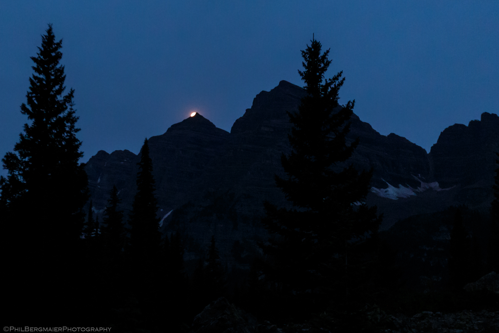
Photo 1 - Moon setting over Maroon Peak
The Pyramid Peak Trail goes south about 1/4 mile before reaching the base of a steep slope. The nice trail then switchbacks up this slope for the next 3/4 mile, during which you gain about 900' of elevation. I was dragging along a bit already, as this was only my second 14er of the summer and my cardio still wasn't where it needed to be. Fortunately, things got easier for me as the morning went on.
Sunrise occurred just after 6 am as we were making our way up the slope. Along the way, we ran into a few mountain goats (Photo 2). This would become a recurring theme throughout the hike. We reached the top of the slope (~11,200') around 6:30 and were treated to a fabulous sunlit view of the Maroon Bells to the west (Photo 3). From here, the trail enters what is known as the "Amphitheater", a large, elevated basin surrounded to the east and west by high ridgelines and to the south by Pyramid's menacing north face (Photo 4). Two gigantic cairns mark the entrance. The scene here is fairly stunning, as Pyramid towers almost 3,000' above our heads (Photo 5).
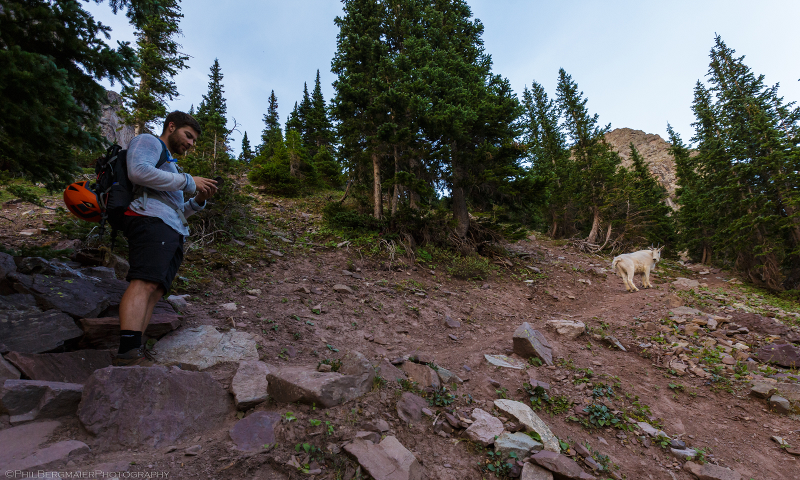
Photo 2 - Matt waiting patiently for this goat to be on his way
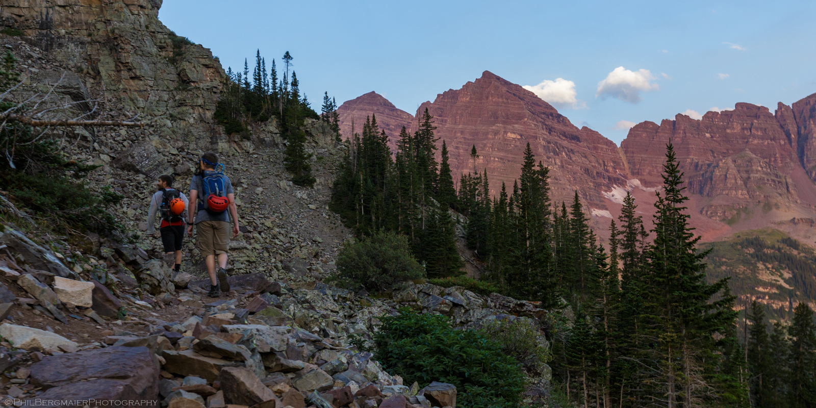
Photo 3 - The Maroon Bells in all their glory
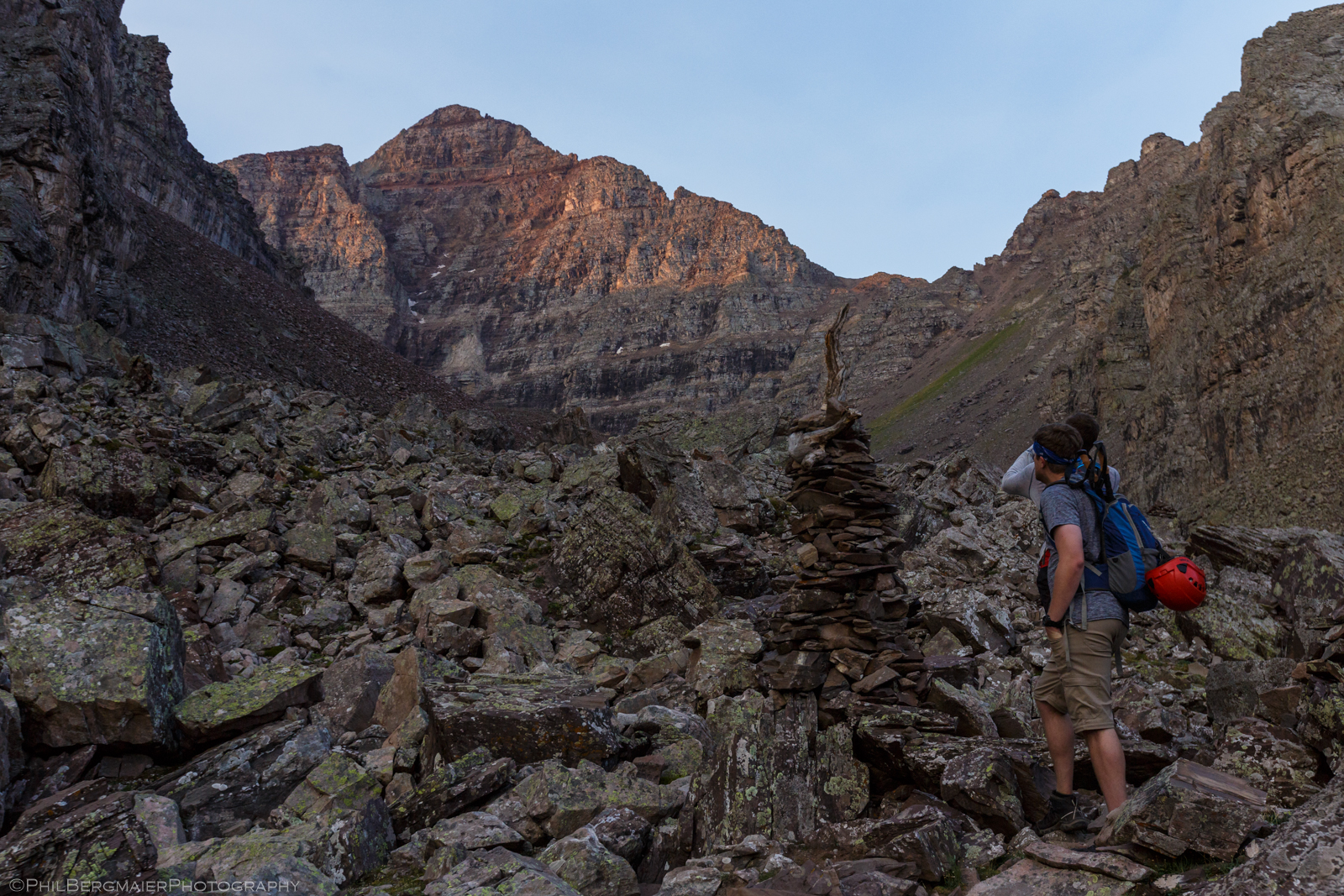
Photo 4 - One of the large cairns guarding the Amphitheater
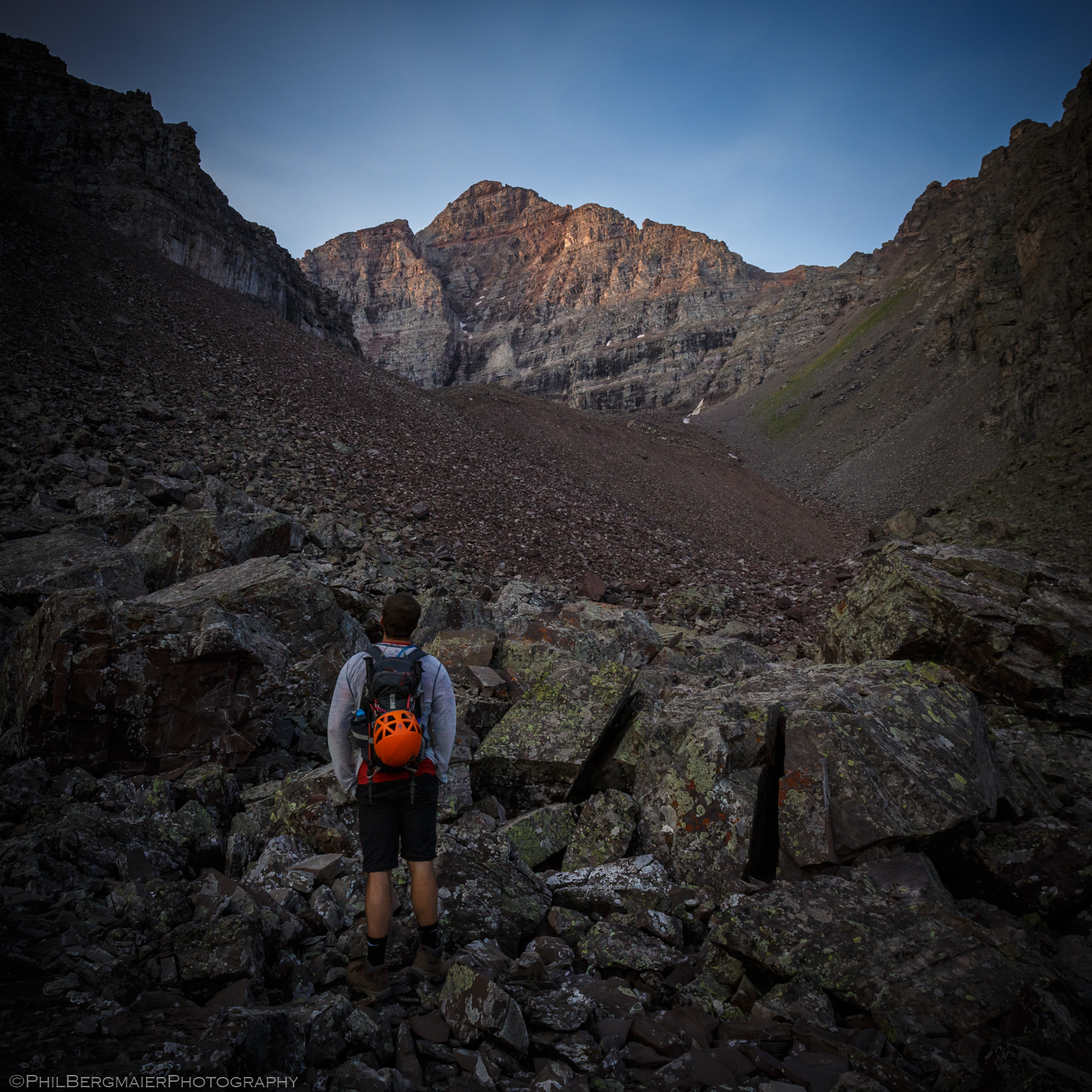
Photo 5 - Matt can't get enough of this view
Although there is in fact a trail that heads up the Amphitheater toward the peak, it disappears sometimes as you cross the rocks and can be hard to follow. We actually lost it at one point and ended up scrambling up the rather mellow scree for most of the way (Photo 6). Eventually, the Amphitheater flattens out near the base of Pyramid at ~11,900', where you get a tremendous view of the peak's north face (Photo 7). This also provides a nice look at the next part of the hike, a 1,000' ascent up the steep, loose, crappy gully/slope to the saddle on Pyramid's northeast ridge.
We spent a few minutes resting here and grabbing a quick bite to eat. It was only 7:20 am and we had already hiked in 3 miles and gained 2,300' of elevation. We were halfway up in terms of elevation with only one more mile to go! However, the most difficult terrain lay ahead of us. We made our way to the steep slope to our east and began to ascend.
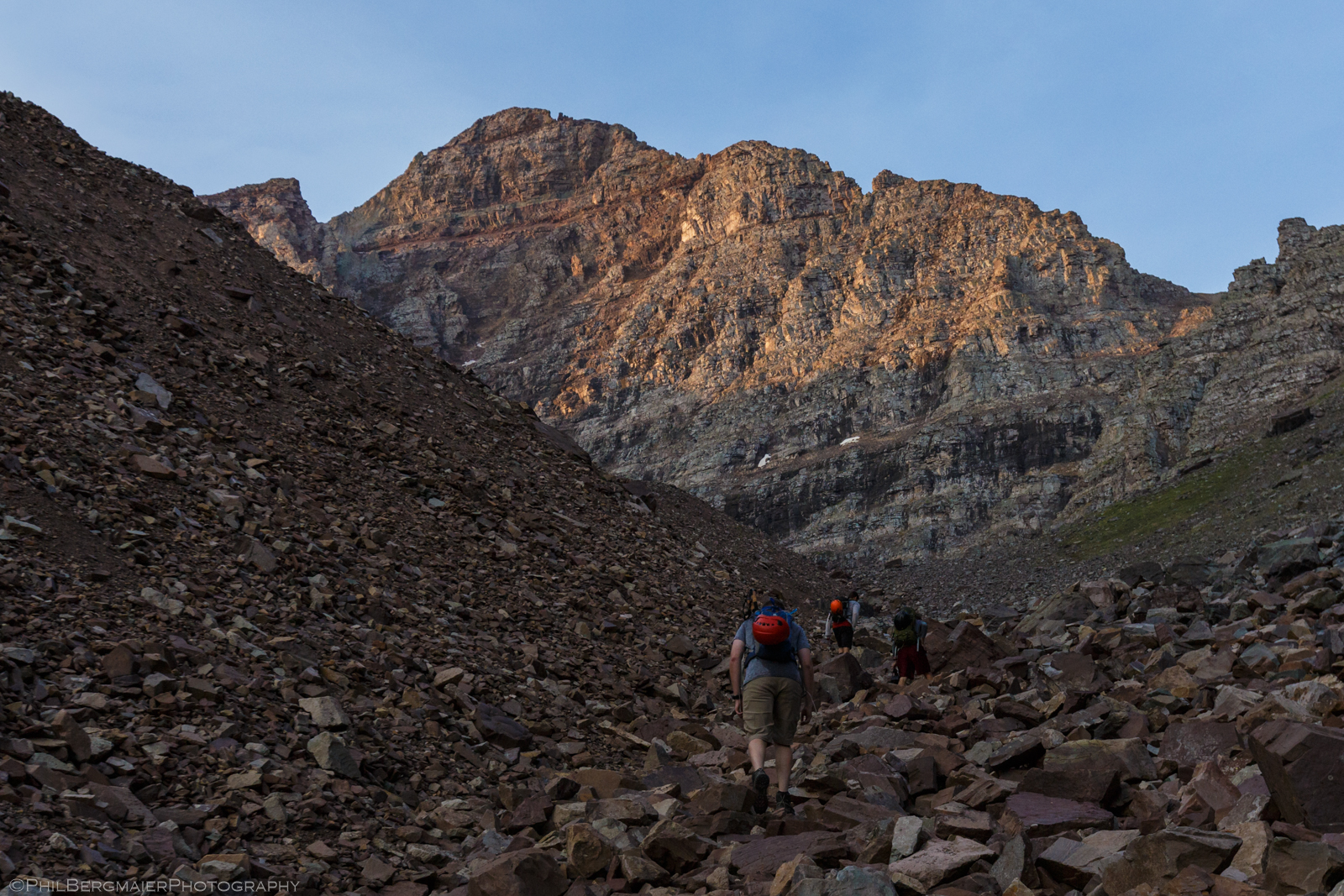
Photo 6 - Following the low point up the Amphitheater (the trail was actually to our right).
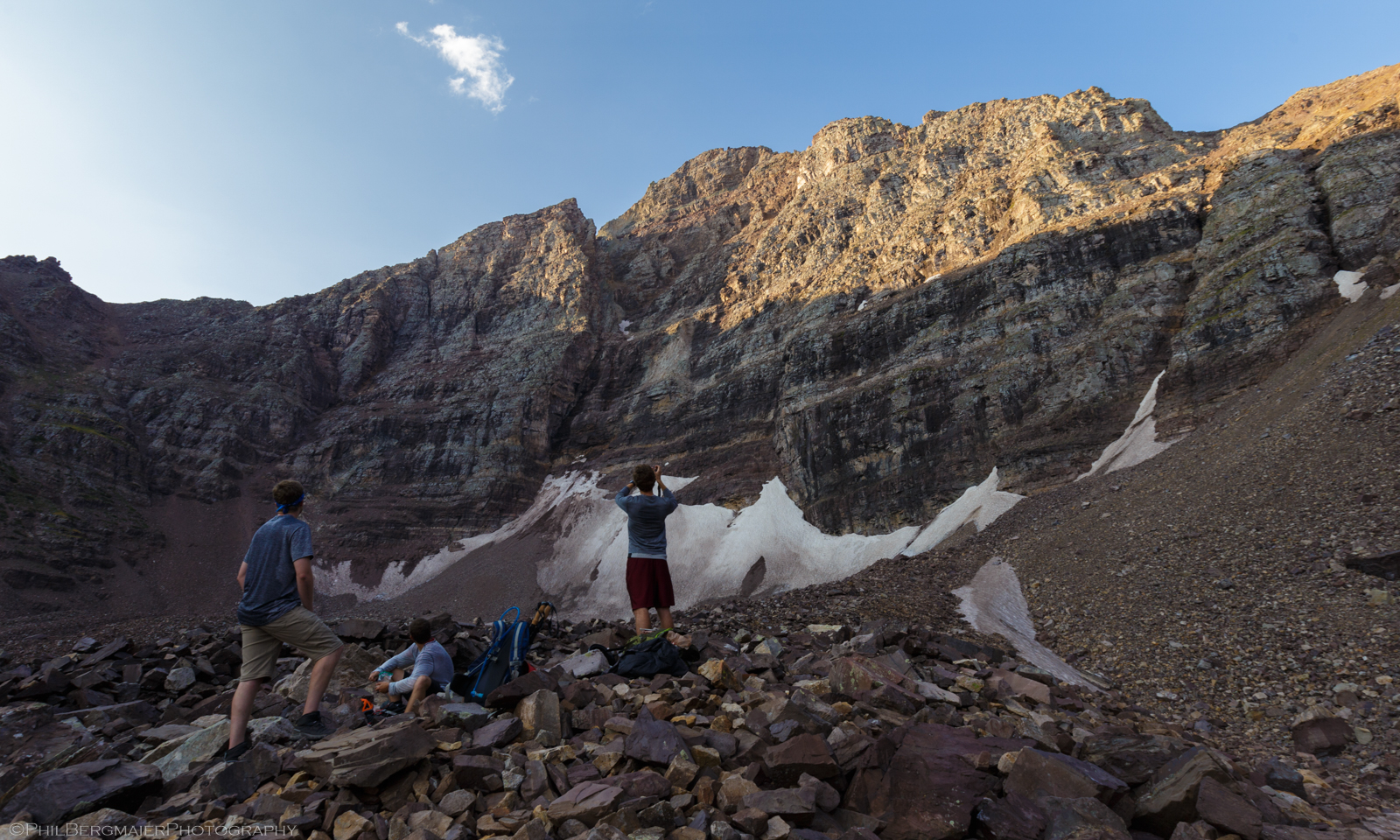
Photo 7 - Resting our legs but feasting our eyes on Pyramid's impressive north face. The route continues up the steep slope on the far left side of the image to the low point along the ridgeline.
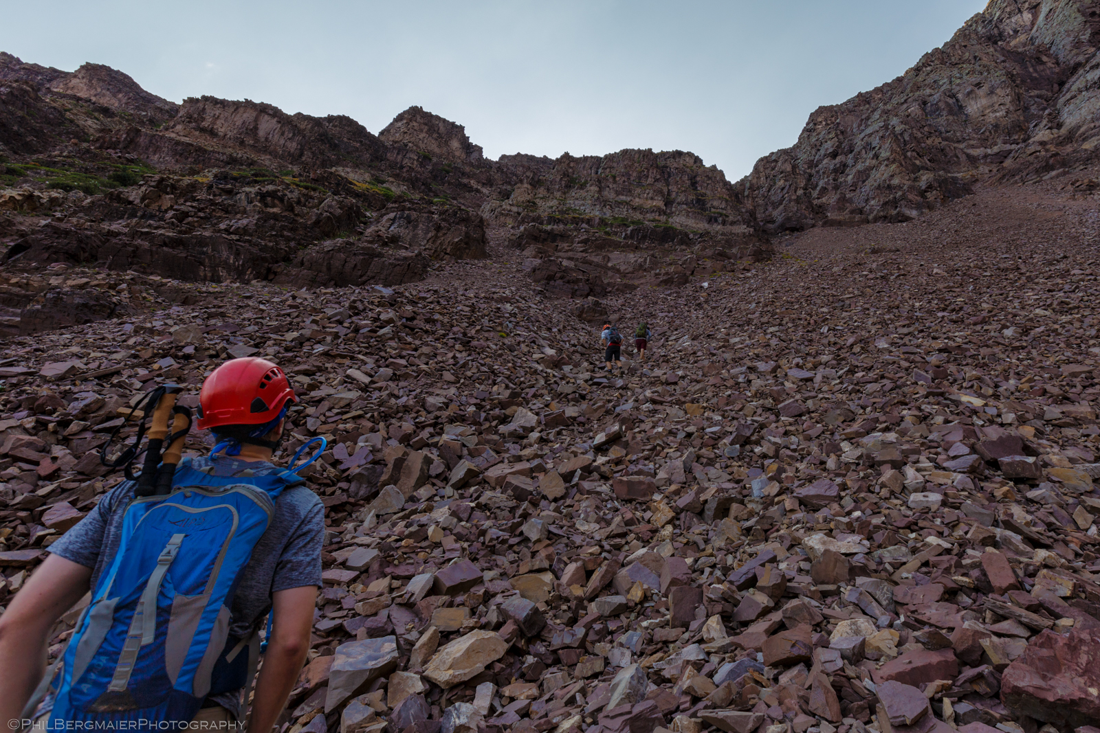
Photo 8 - The scree field leading up the bottom of the steep slope to the northeast ridge
I'd say that this part of the hike was the worst of the day, although it wasn't really all that bad in hindsight. But it was quite the arduous trudge. We started by making our own way up the scree field at the very bottom and then into one of the many small gullies (Photo 8). I eventually decided that climbing up some of the class 3 rock on the side of the gully was easier and more fun. A few hundred feet up, we ran into the actual trail (Photo 9) and followed it the rest of the way up.
As we got higher, the view behind us began to open up and we were able to see several other nearby 14ers in addition to the Bells, including Snowmass Mountain and Capitol Peak (Photos 10, 11, & 12). Oh, and Pyramid Peak as well, whose north face continued to be an incredible sight to see (Photo 13). I continued to lag behind the rest of the crew, but only by about 5 minutes or so.
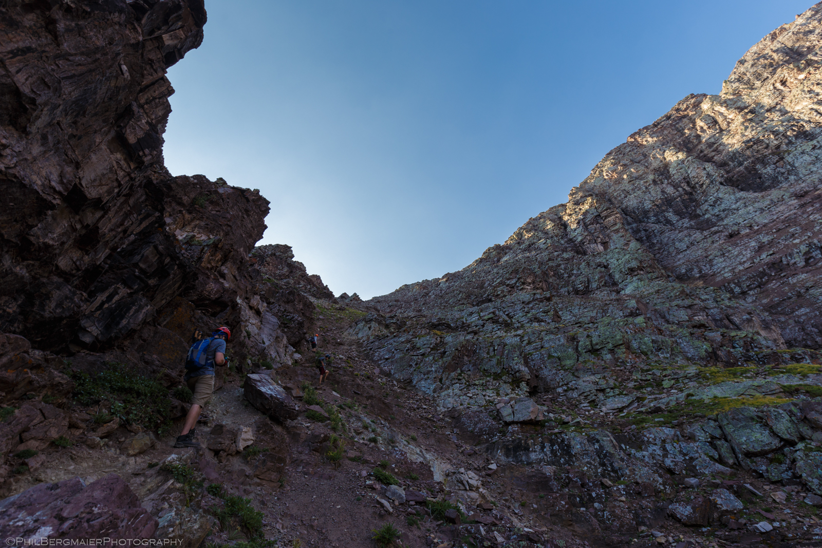
Photo 9 - Tim along the trail about halfway up the steep, loose slope to the northeast ridge
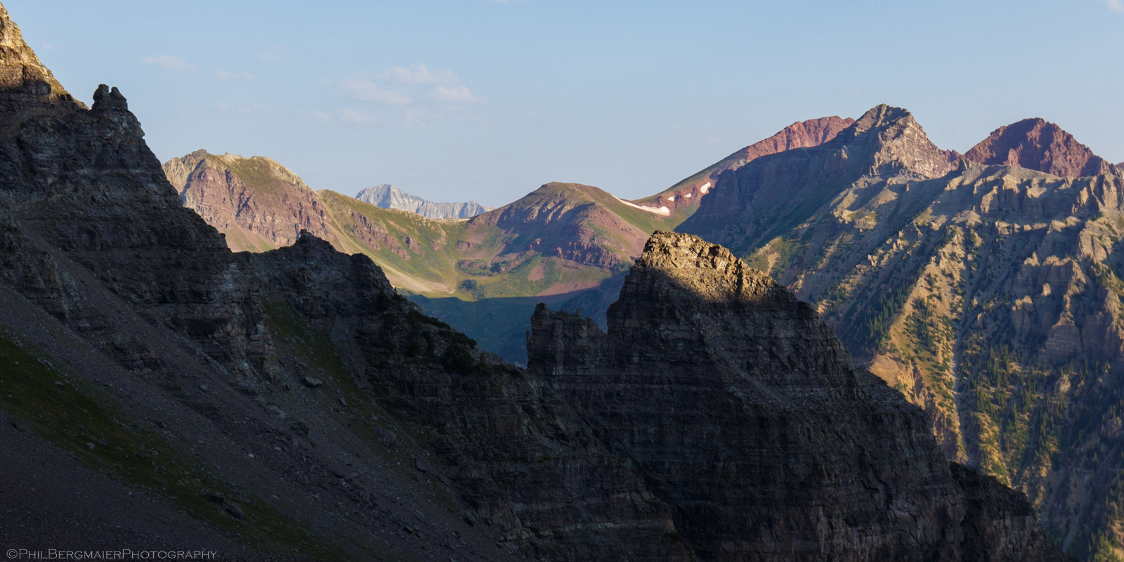
Photo 10 - The view to the northwest of 14er Capitol Peak off in the distance
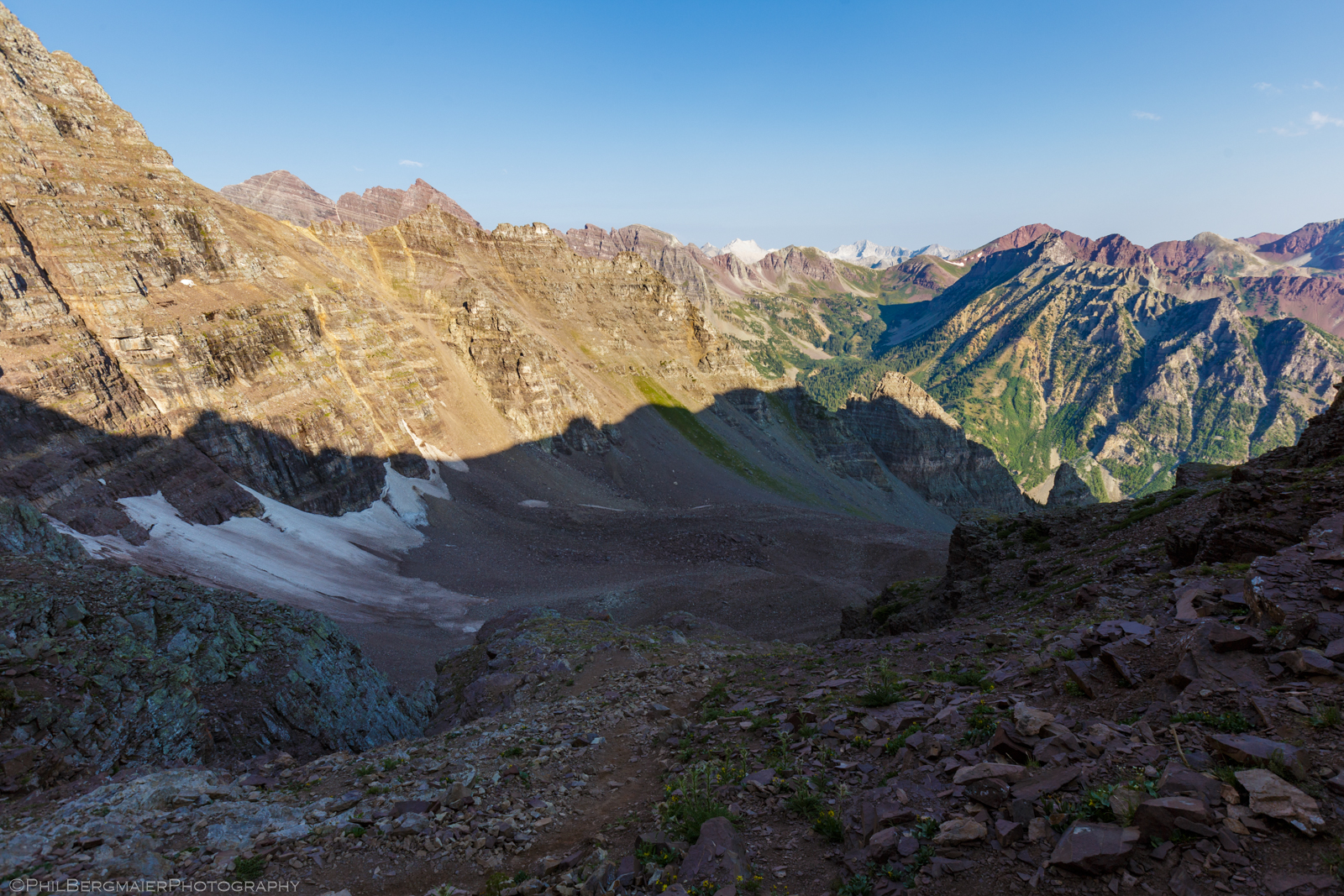
Photo 11 - Wide view of the Amphitheater and (from left to right) 14ers Maroon Peak, North Maroon Peak, Snowmass Mountain, and Capitol Peak
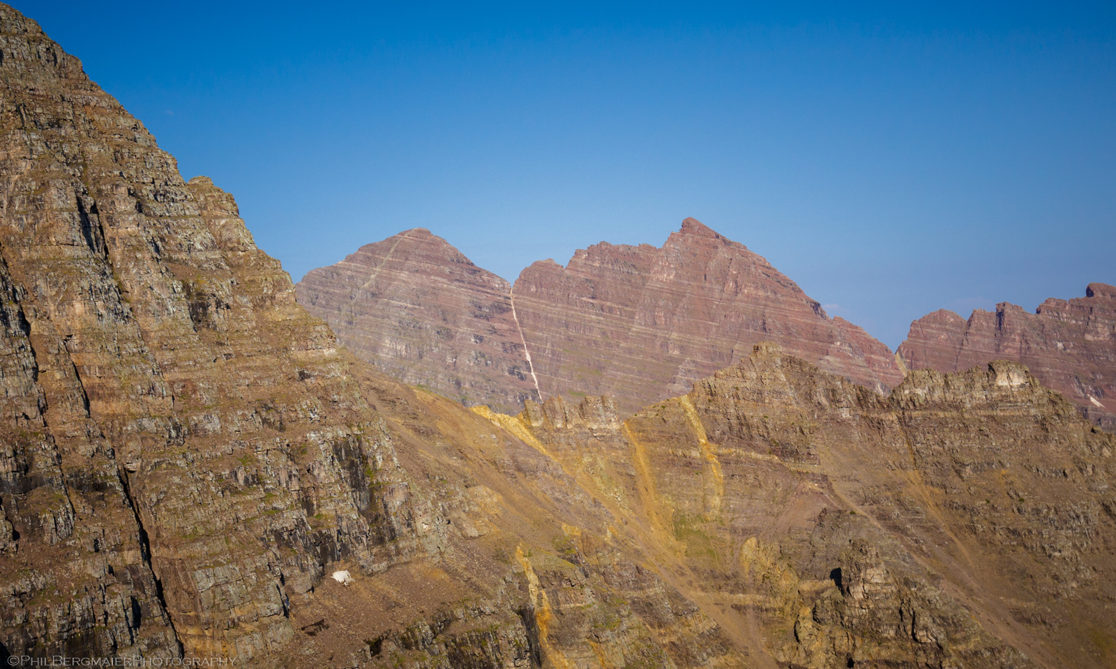
Photo 12 - Closeup view of the Maroon Bells and the famous Bells Traverse ridgeline that connects the two peaks
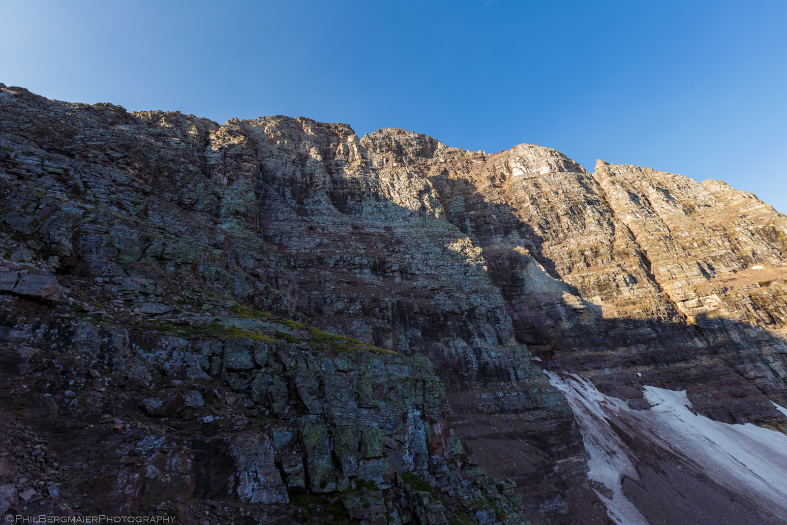
Photo 13 - Another look at Pyramid's north face
As we reached the saddle along the ridge at 13,000', the mountain goats returned (Photos 14 & 15) and were certainly not all that shy! They liked to sorta sneak up on us to within about 6-8' and just chill as we went about our business. If we took a few steps toward them, they'd scurry away, only to come back once we turned around. Funny little creatures! My buddy kept saying they like to drink our urine... not sure if that's true. However, I have heard stories of them eating (or at least chewing on) hiking poles and other weird stuff, so there's that.
This concludes the hiking part of the journey up to the summit.
SUMMIT DAY – THE CLIMB
Once at the ridgeline, the trail turns southwest and begins to follow the ridge (Photo 16). At around 13,100', the actual trail disappears and the remainder of the route to the top is marked by cairns. Here is where the climbing begins. The route the rest of the way up does not follow the ridgeline proper. Rather, it stays well below it to the left (south) on Pyramid's east face.
There are many ledges along the east face. Loose rock often sits atop these ledges. If you're not careful, it can easily be knocked down the mountain (and possibly onto a climber below). If you are able to follow the cairns all the way up, most of the climbing will probably be easy class 3. There are a couple more difficult sections, though.
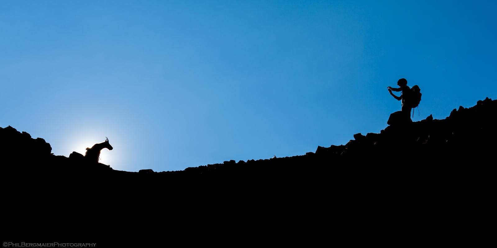
Photo 14 - Mike and a goat providing me with an excellent composition
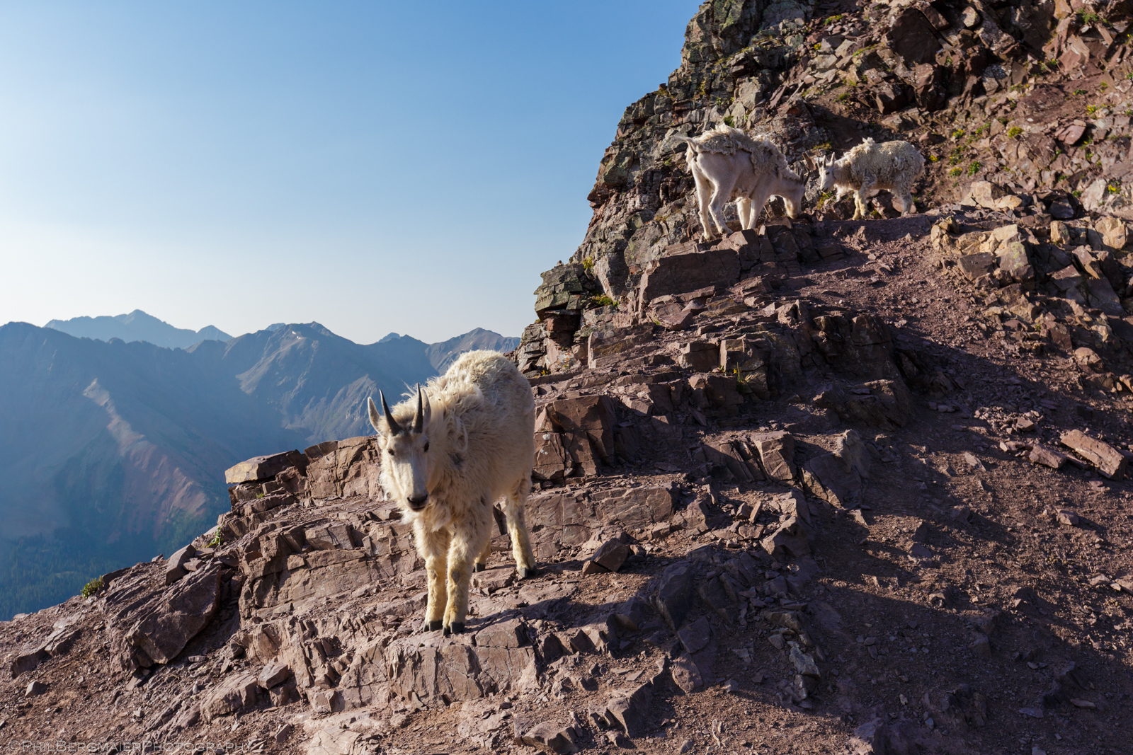
Photo 15 - Goat! Goat! Goat! Also, 14er Castle Peak off in the distance.
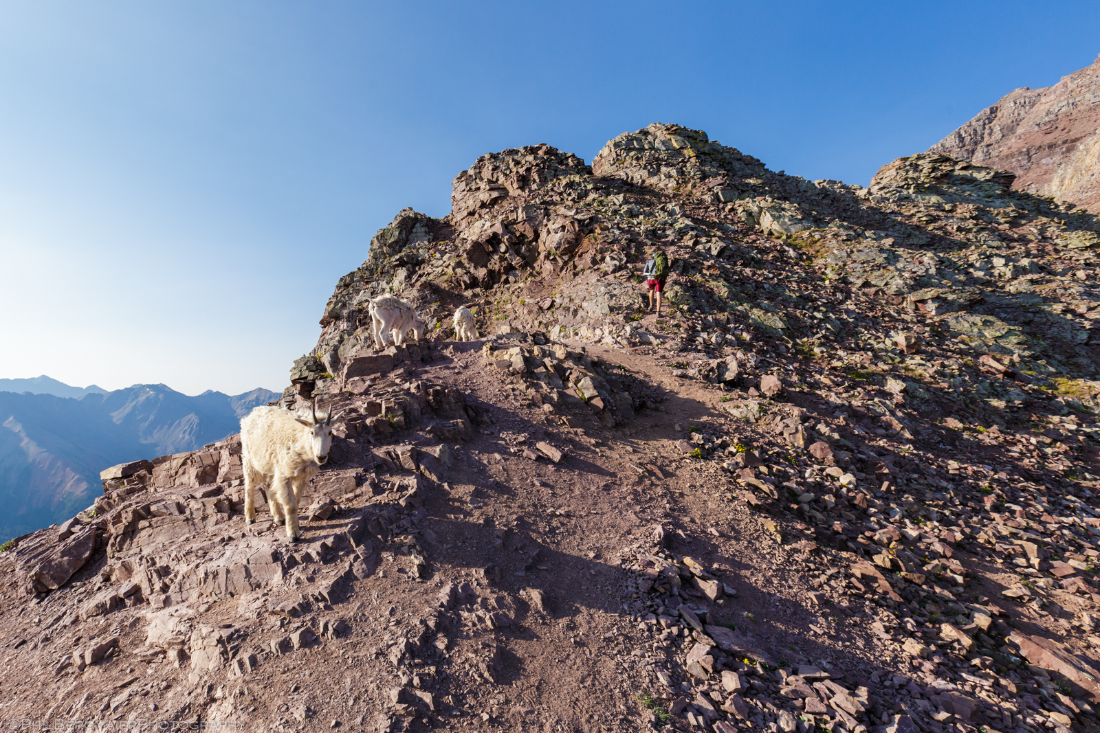
Photo 16 - Mike taking the trail along the top of the ridge toward Pyramid
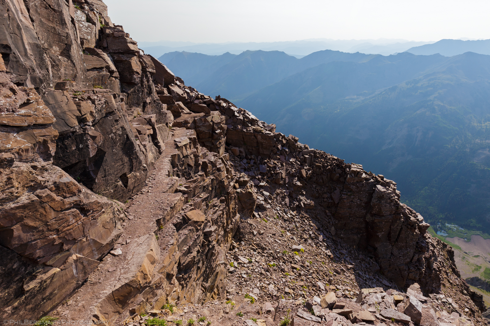
Photo 17 - Looking back at the narrow ledge and "Leap of Faith" after we crossed it
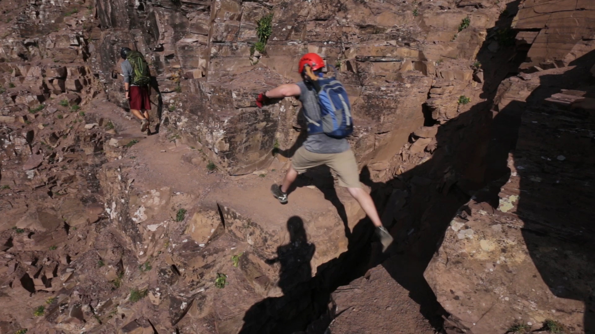
The first challenge, at ~13,300', is the so-called "Leap of Faith", a 3-4' wide gap in the ledge that you must jump (or step) over. This is followed immediately by the "Cliff Traverse", a very narrow, exposed ledge that you have to cross (Photo 17). The "Leap of Faith" is really not bad at all... but if you don't like exposure, it might screw around with your nerves a little bit. The "Cliff Traverse" also looks worse than it is. Most people probably walk across it and say "Oh, that was a piece of cake!"... well, that's at least what we said. The video below shows Mike, Tim, and Matt passing through this section.
Only a short time later, at ~13,500', you reach the next challenge: the "Green Wall" (Photo 18). This is a 100-150' section of steep, light greenish/yellowish rock that would probably be rated difficult class 3. I stayed left on the way up this section, although my buddies stayed right. There could be a class 4 move in there somewhere, although we didn't encounter it. While it is steep, there are plenty of handholds and footholds. However, the rock is especially loose in spots. I ended up sending a rather large one careening down the mountain.
Above the "Green Wall", the route continues to ascend over a series of short 5-10' ledges to about 13,750'. Again, most of this is solid class 3 if you follow the cairns, but you can easily find harder pitches to climb if you want. We got a little bit off route after 13,750' and headed up to the base of the summit's east wall (Photos 19 and 20). We were below the actual route at this point, so we climbed back up to the cairns and continued on our way.
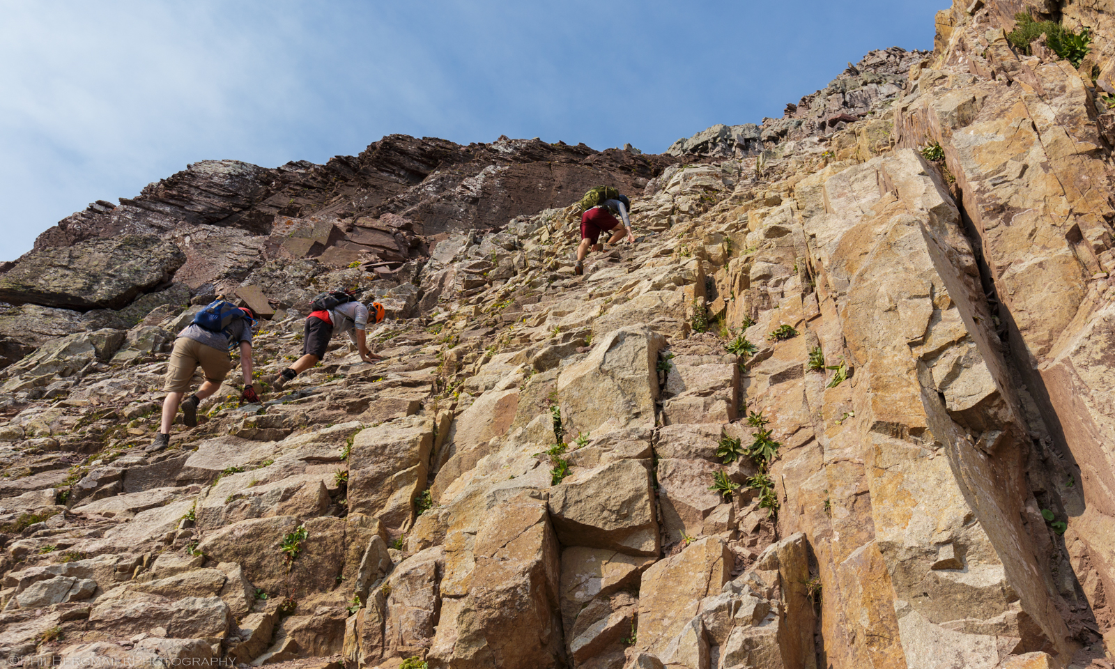
Photo 18 - (left to right) Time, Matt, and Mike climbing up the "Green Wall"
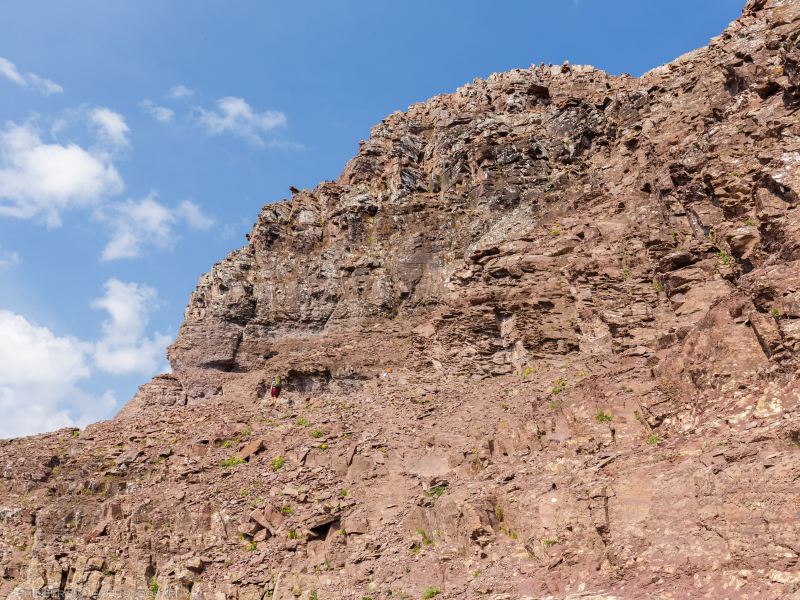
Photo 19 - The east wall below the summit, with the class 4 darker rock section about 2/3 of the way up
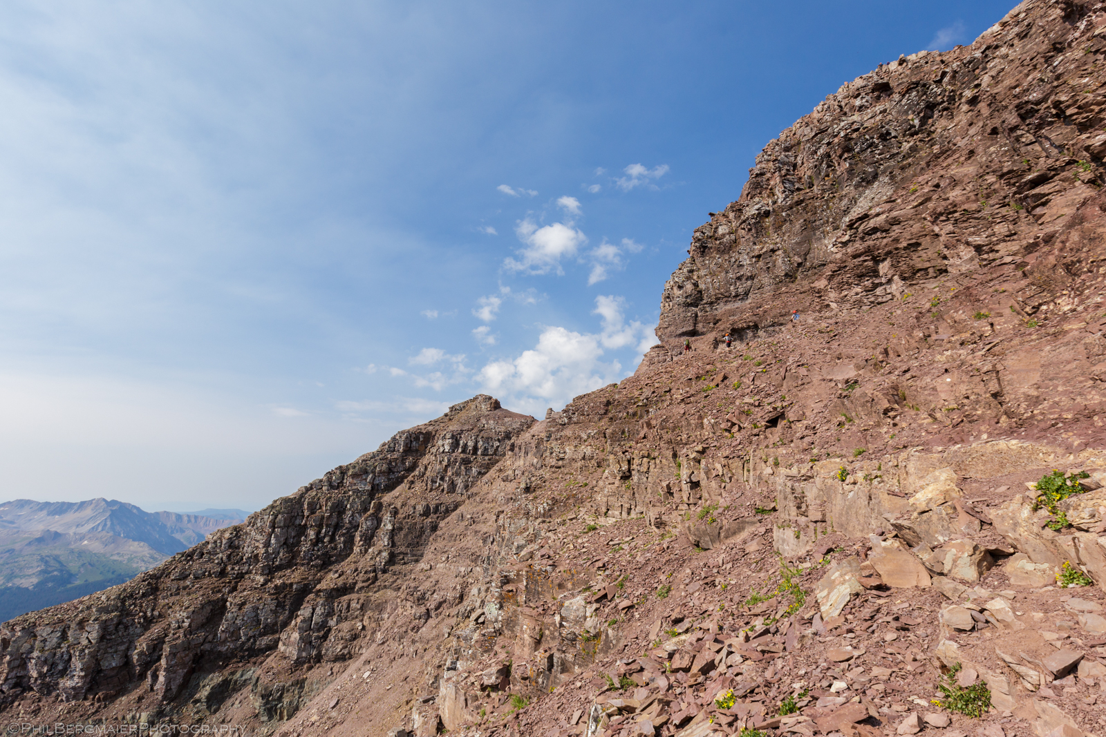
Photo 20 - From the same point as Photo 19, only with a better view of some of the ledges and steepness of the terrain
About 100' below the summit, there is a steep wall of darker rock (Photo 19). The cairned route avoids these rocks, bypassing them to the right (northeast). However, I decided I wanted some good class 4 climbing, so I headed to the darker rocks and negotiated my way up one of the cracks. Again, this was not on-route. If you want to take the easiest way from here to the summit, stay right on your way up where the terrain is less steep! There should be a few cairns guiding the way.
Photos 21 and 22 show the view from the climb up the class 4 section right below the summit. I finally reached the top at about 10 am. Less than 5 hrs one-way and ~4,600' of elevation gain, not too shabby for my out-of-shape rear end. As per usual with these Elk Range climbs, the views from the top were stellar (Photos 23 and 24). Cell phone reception was not, surprisingly. When we were on Maroon Peak a few years back, reception was fine. Odd! Eventually, we were also joined, once again, by GOATS! (Photo 25)
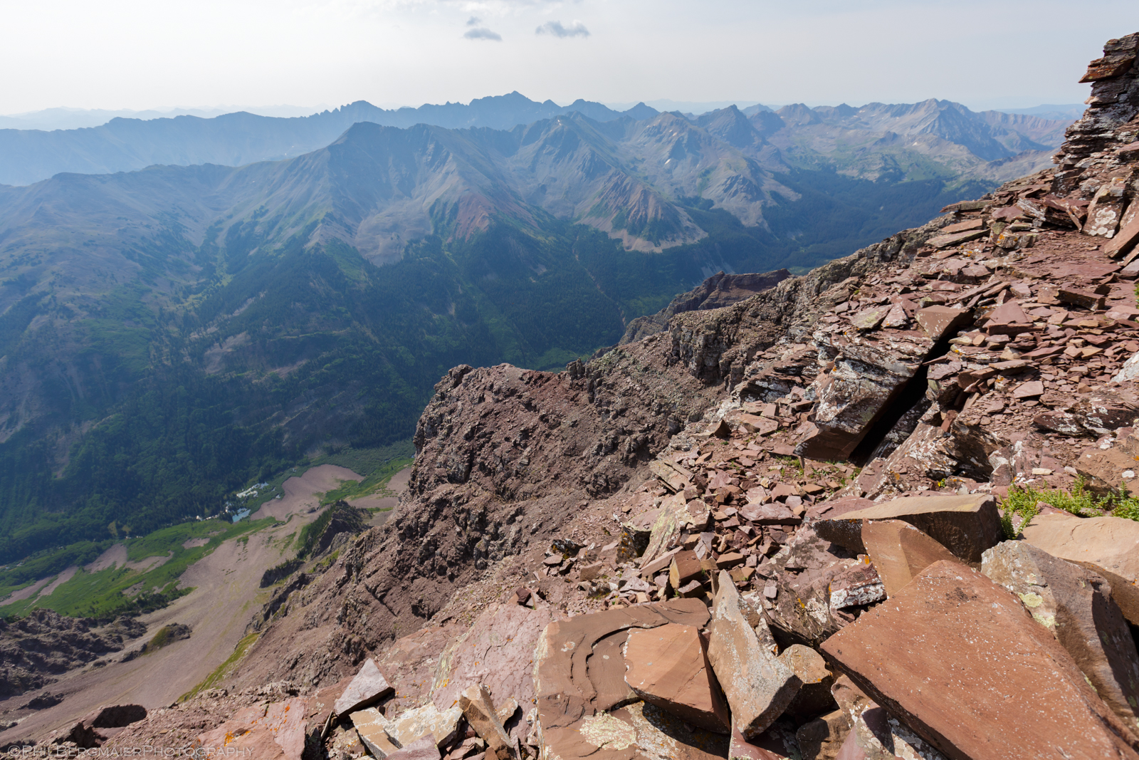
Photo 21 - Looking southeast over the East Maroon Creek Valley toward 14er Castle Peak
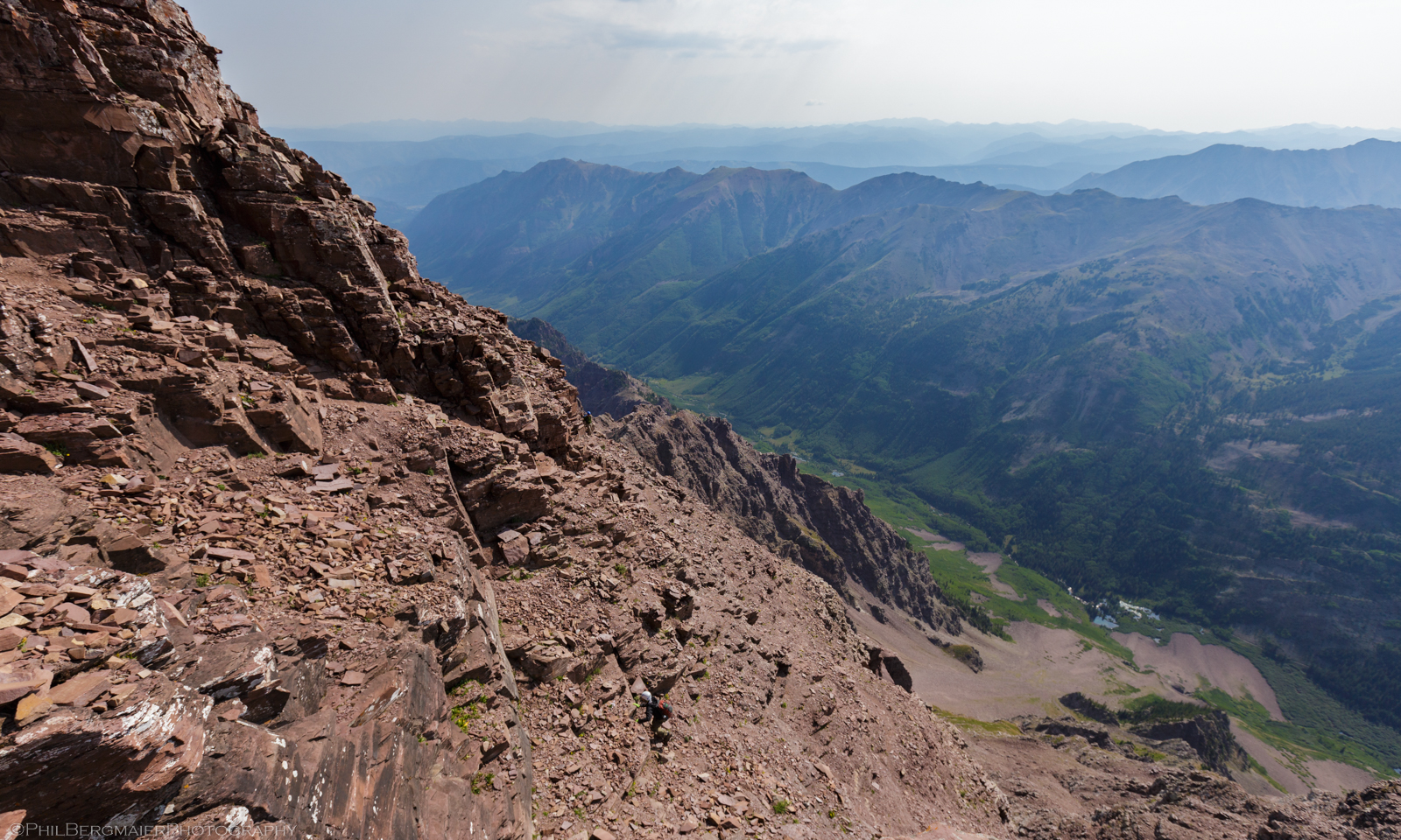
Photo 22 - Looking back on a few climbers making their way up the final ~200' to the summit. The actual route ascends from the center of the image to the top left, just below the wall of rock that is in shadow.
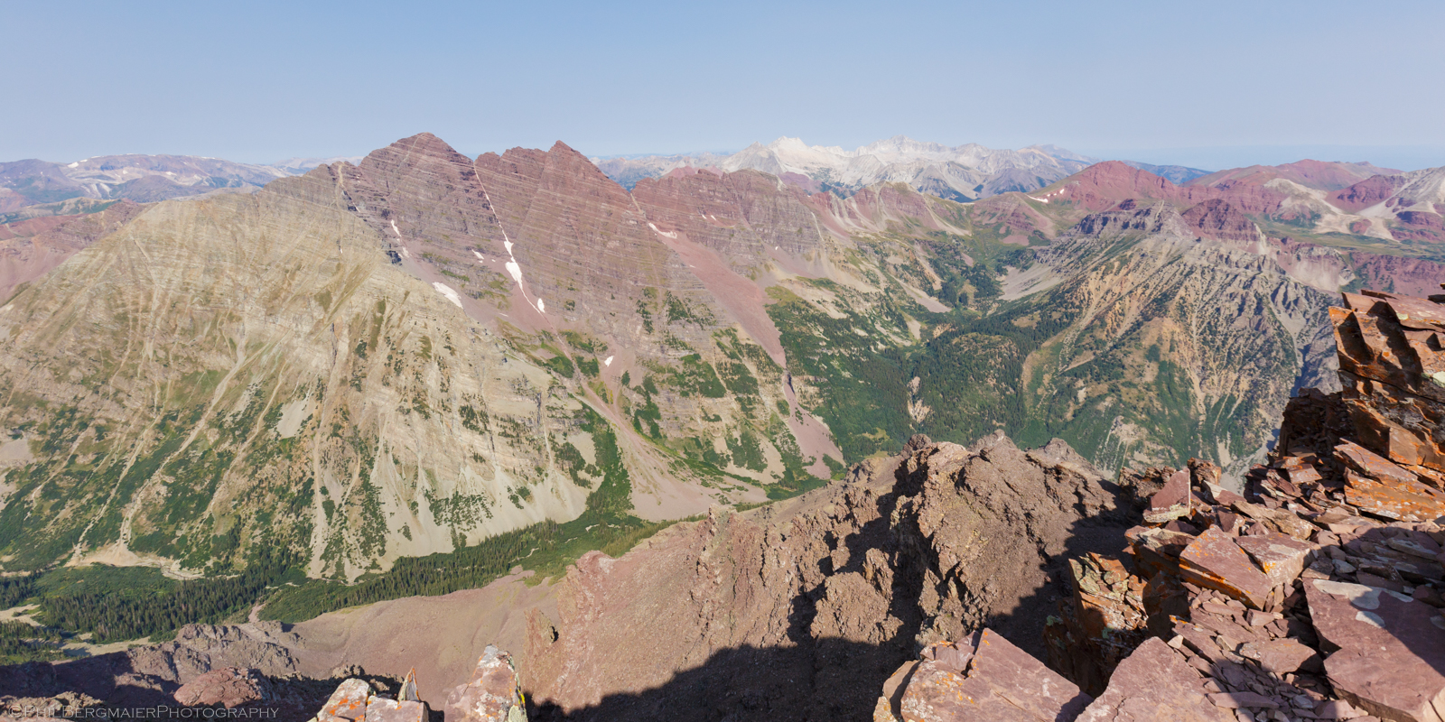
Photo 23 - Feast for the eyes! View to the northwest of (from left to right) 14ers Maroon Peak, North Maroon Peak, Snowmass Mountain, and Capitol Peak
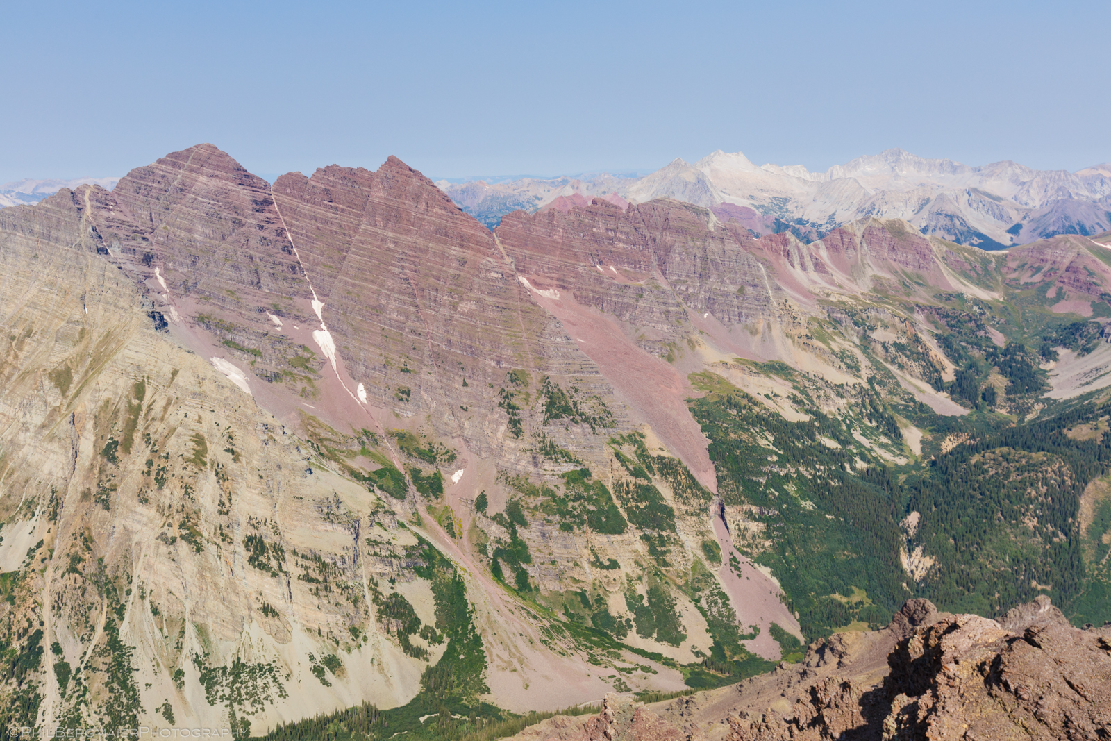
Photo 24 - A closer view of the 14ers in Photo 21
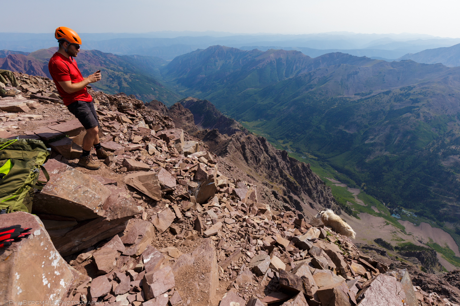
Photo 25 - Matt shooting a mountain goat. With his phone camera.
We stayed on the summit for close to half an hour and were joined by 10-15 others. Pyramid Peak has an insanely-steep west face, as you can see in the video below. Needless to say, a fall there would be the end of it. I'll tell you what, though, some folks make some interesting decisions when they see drops like that (Photo 26). Yeah, ok...
Anyway, the weather was fantastic, only a few very small cumulus clouds floating around. Nothing imminent. Three of the four of us are meteorologists, so we have a pretty good idea of what to look for in terms of developing storms. However, we knew that afternoon storms were indeed in the forecast that day, so we didn't want to linger too long. I got my summit pic (Photo 27) and we were heading back down by 10:30.
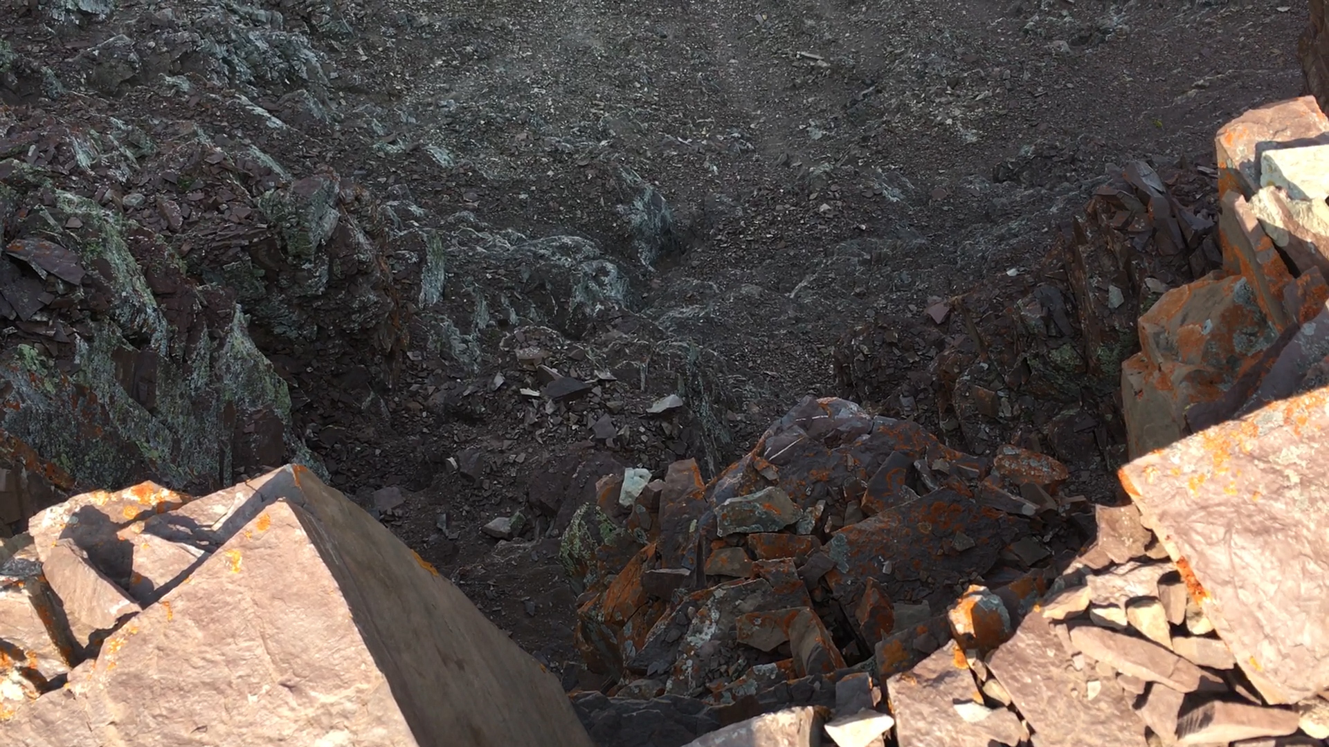
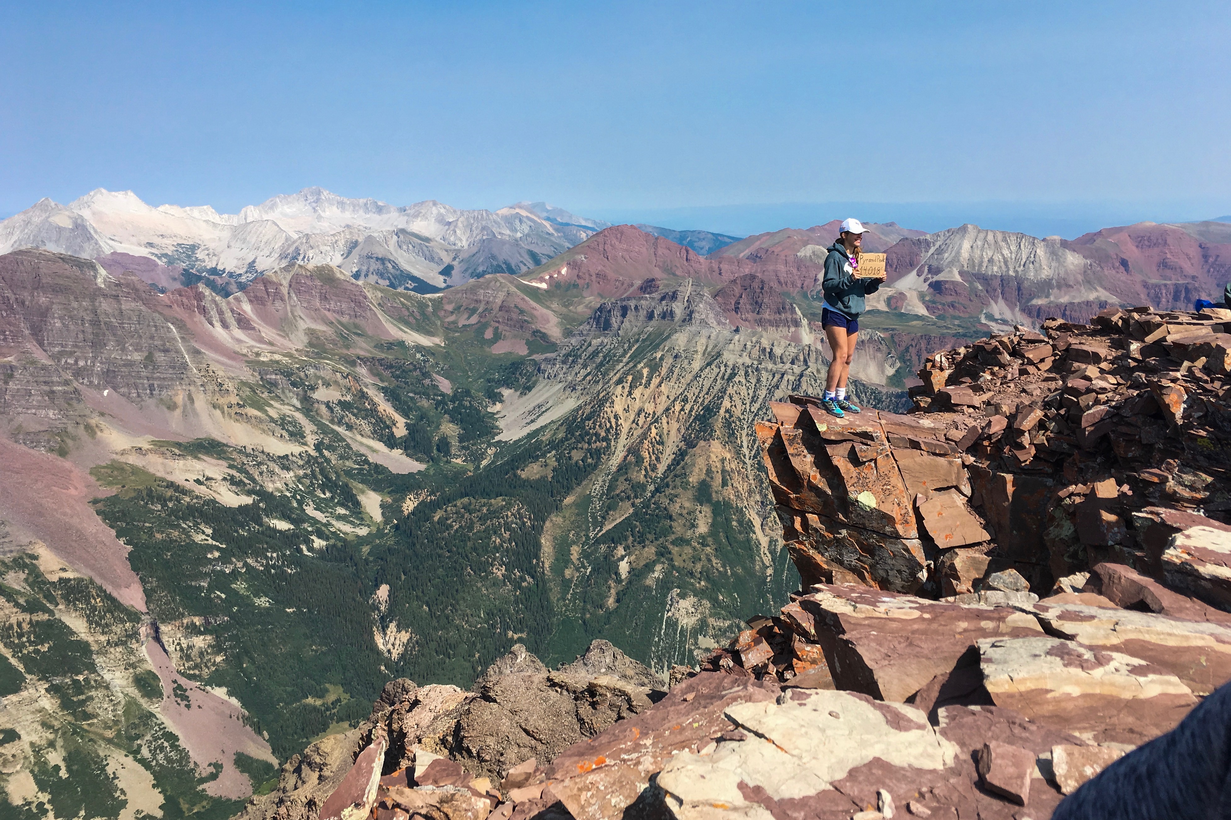
Photo 26 - "Walking the plank"
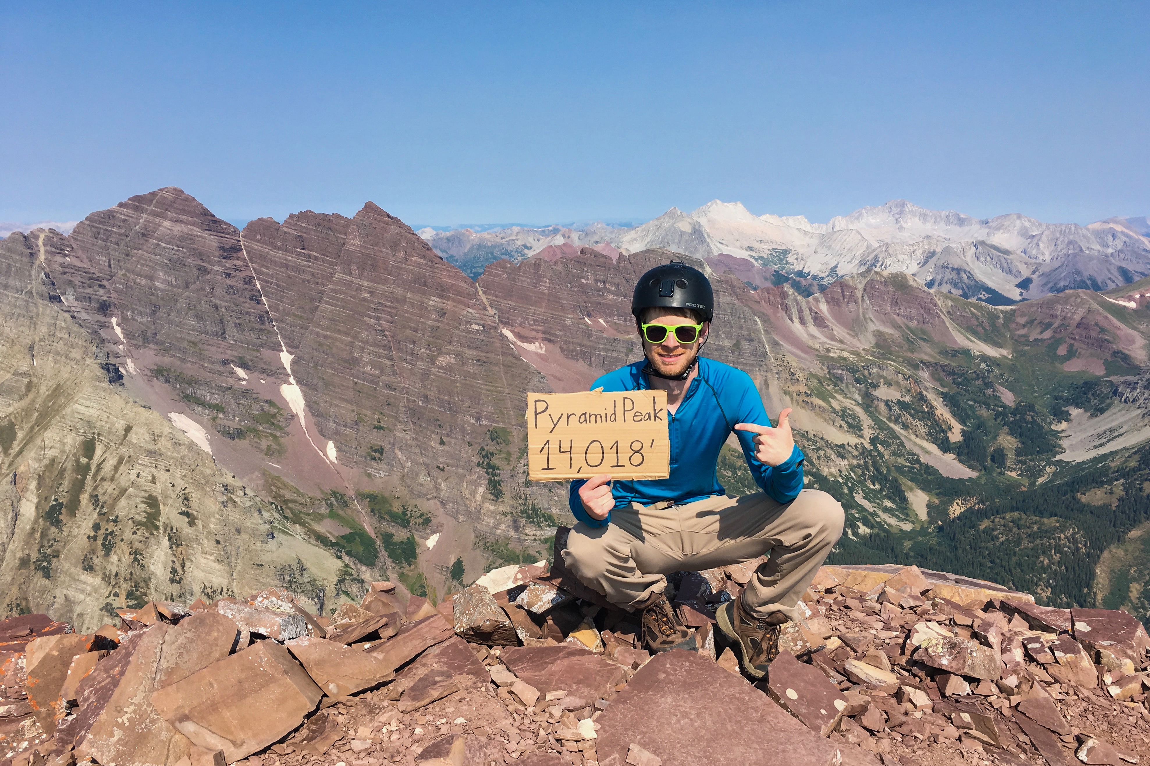
Photo 27 - Official summit pic, ironically NOT taken from the official summit
SUMMIT DAY - THE DESCENT
We made great time on the way down! Interestingly, we thought the class 3/4 downclimbs were pretty easy for the most part, even on the "Green Wall." Photo 28 shows a good example of us climbing down one of the class 3 ledges. We made it back to the "Leap of Faith" section by 11:20, although we weren't really in all that much of a hurry. Photo 29 shows a great view of Pyramid's east face from this point, including the obvious "Green Wall" extending far down the mountain.
Passage back across the narrow ledges and "Leap of Faith" was trivial, albeit quite photogenic (Photos 30-35). Clouds were beginning to build so it was time we got off the ridge and back down to the Amphitheater. We made good time, arriving back to the saddle along the ridgeline at about 11:50.
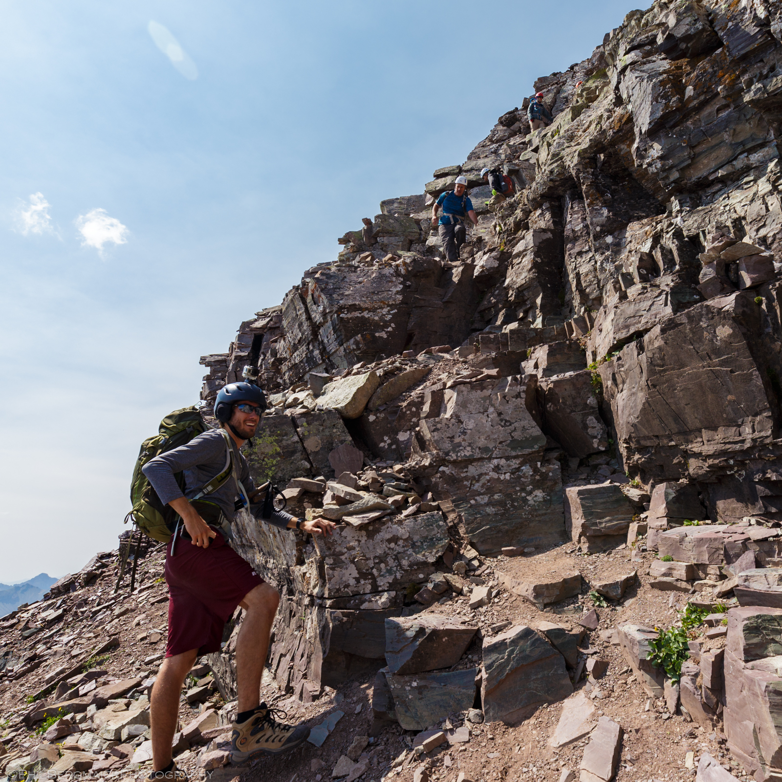
Photo 28 - Mike awaiting the rest of our crew and a few others who joined us for some of the descent
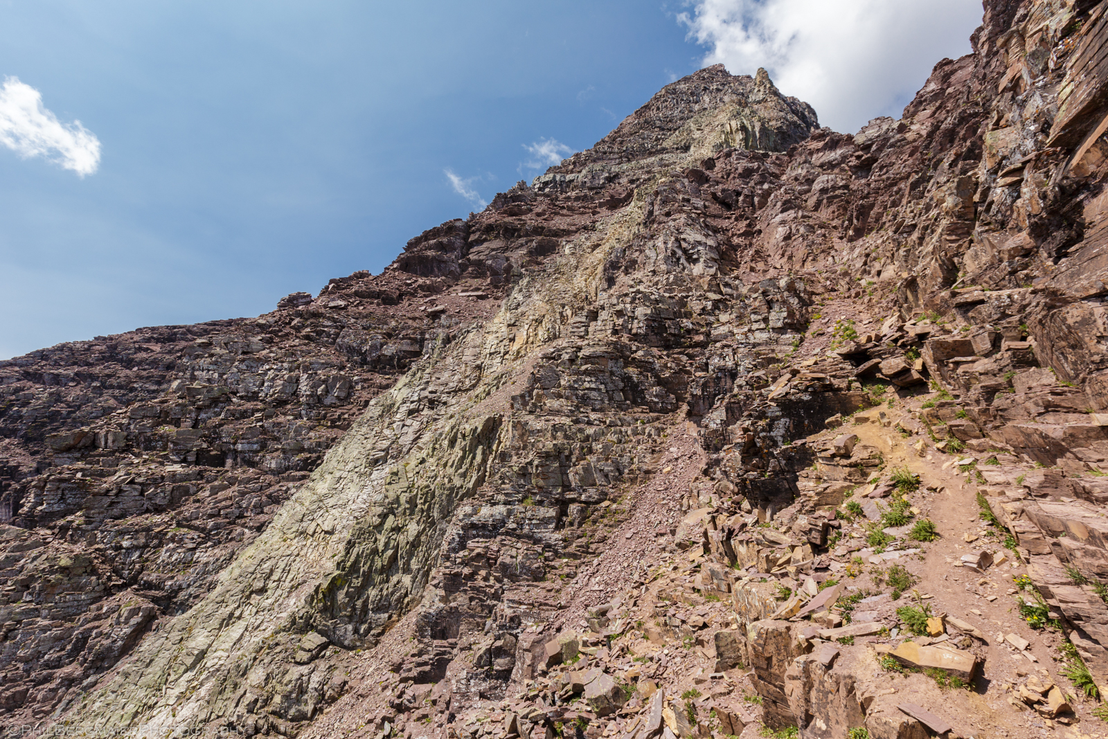
Photo 29 - Pyramid's east face and "Green Wall" from 13,300'
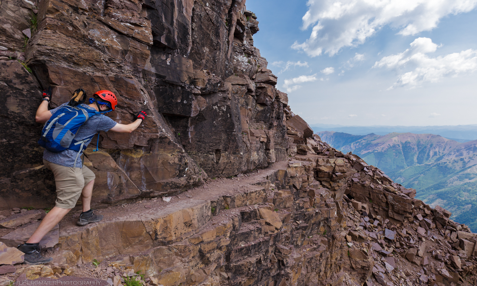
Photo 30 - Tim on the narrow ledges
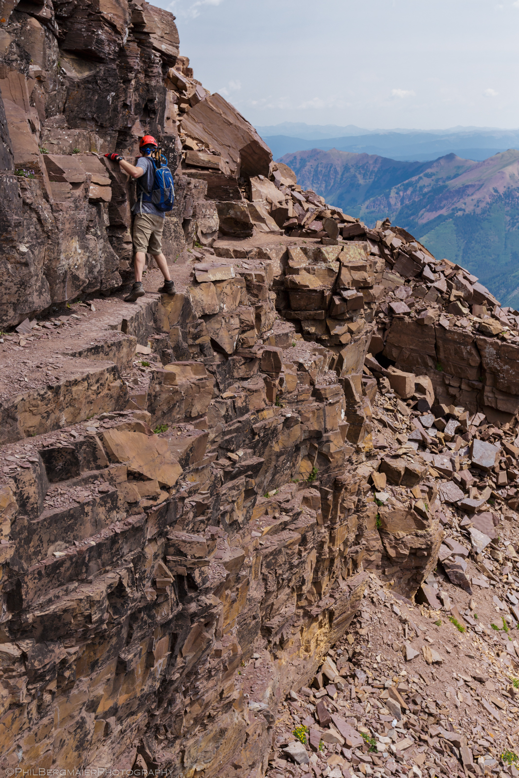
Photo 31 - Tim almost across!
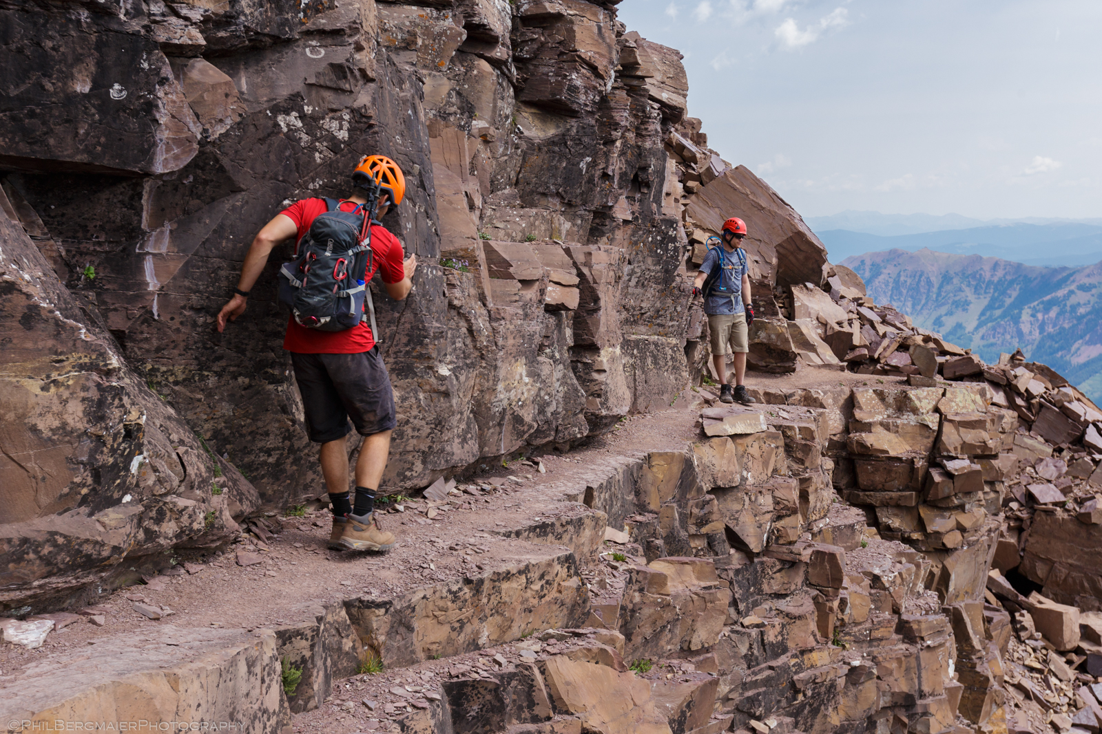
Photo 32 - Matt's turn
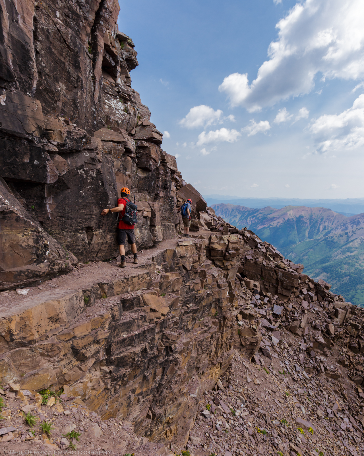
Photo 33 - Matt and Tim being so brave
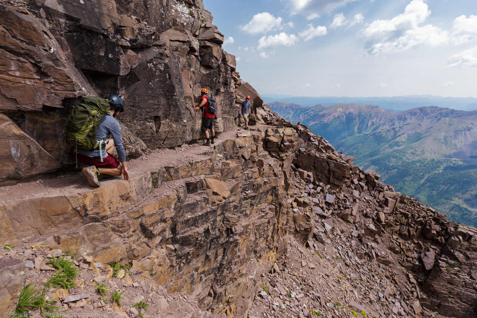
Photo 34 - Crouching Mike, Hidden Dragon
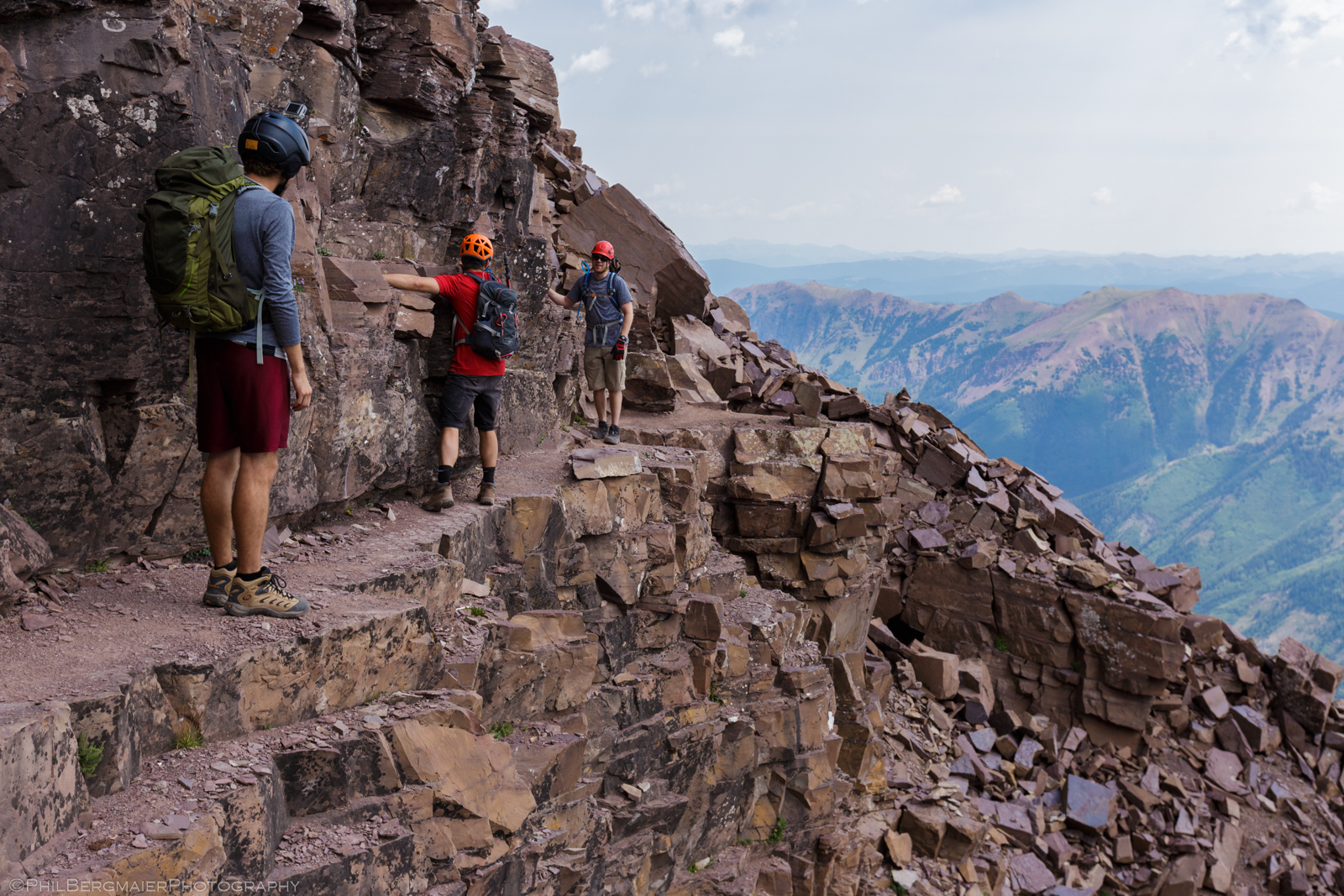
Photo 35 - Well done!
We paused for a couple minutes at the saddle to remove the rocks from our shoes, tease the mountain goats, and grab our last photos of Pyramid's east face (Photo 36). Then we headed down 1,000' on the steep, loose trail, finally reaching the bottom (~12,000') about half an hour later. We again rested our sore feet, shed our helmets and a layer or two (it was warm!), and grabbed a bite to eat. A large cloud had settled atop Pyramid by this point, providing us some welcome shade but also suggesting that the weather was perhaps starting to turn. We had passed by two climbers on their way up about an hour prior, so we were hoping they were making their way down by now.
The rest of the descent was quite uneventful. We arrived back at the enormous cairns at the entrance to the Amphitheater around 1:15 pm (Photo 37). From there, the 900' hike back down the switchbacks went quickly. Along the way, we did feel a few drops of rain but nothing came of it. It also get a bit windy, but I do not recall hearing any thunder. Once back down in the valley, we took a quick break at a spot with a wonderful view of the Bells (Photo 38). There's a wall-hanger!
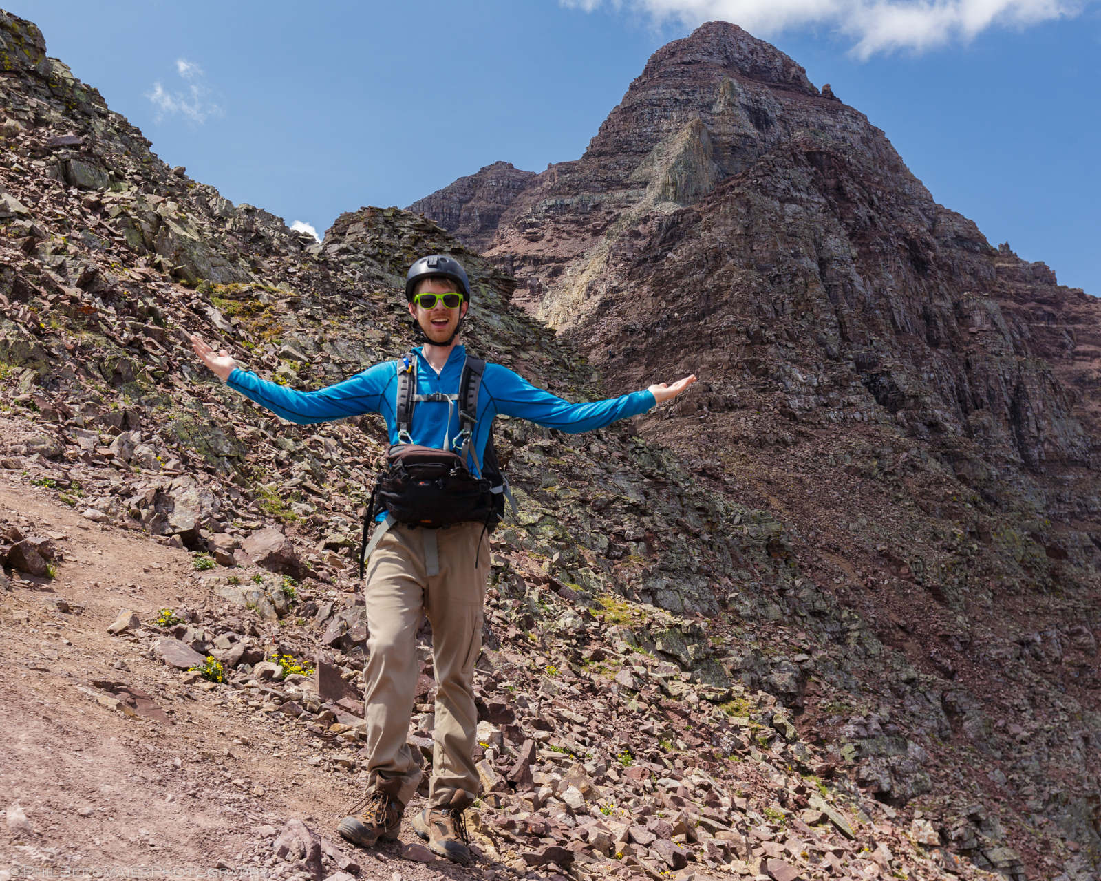
Photo 36 - Me and my silly pack
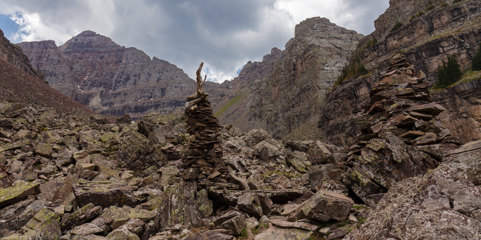
Photo 37 - Storm clouds brewing over the peak!
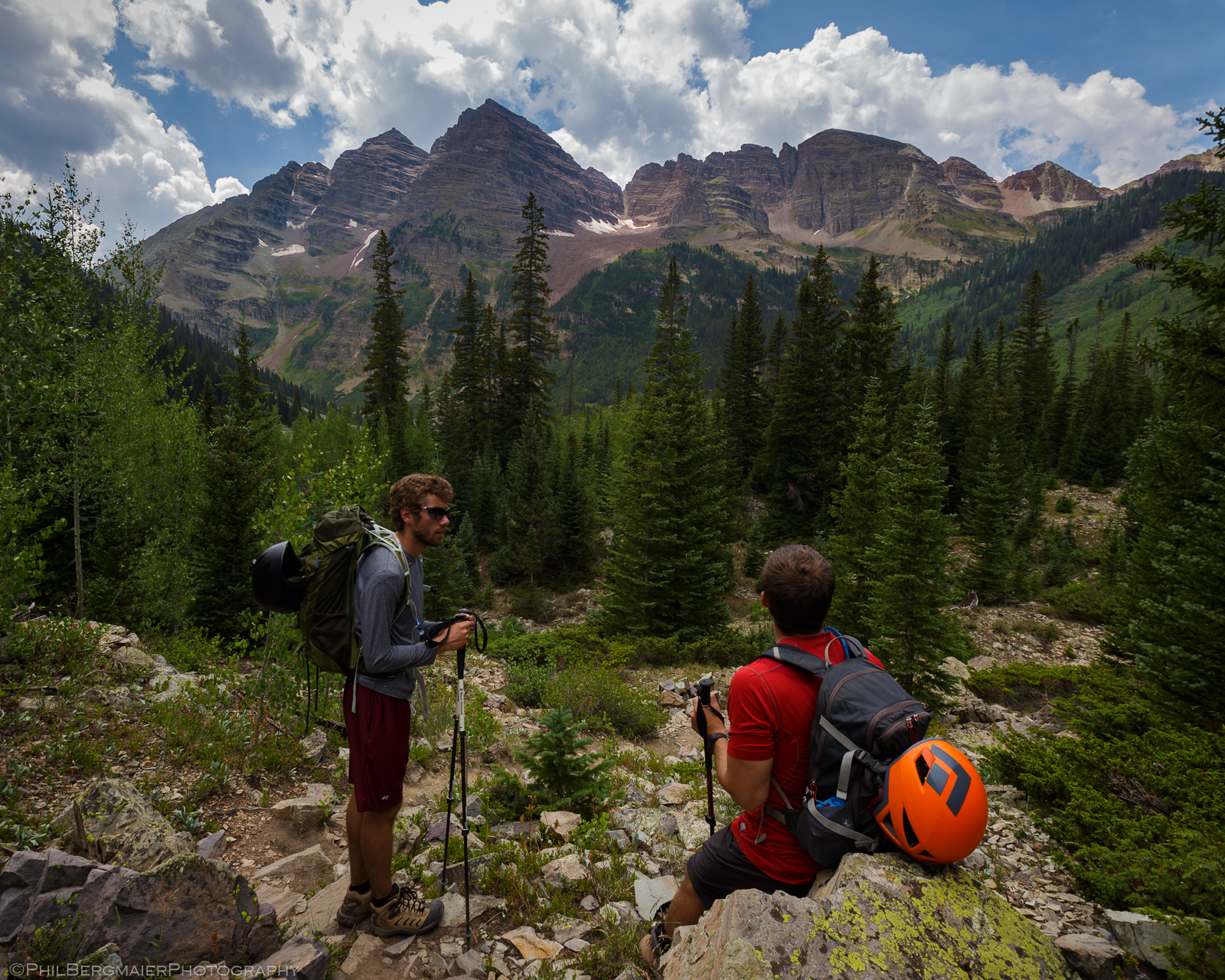
Photo 38 - Oh hi there Bells! We'll be back for you again another day!
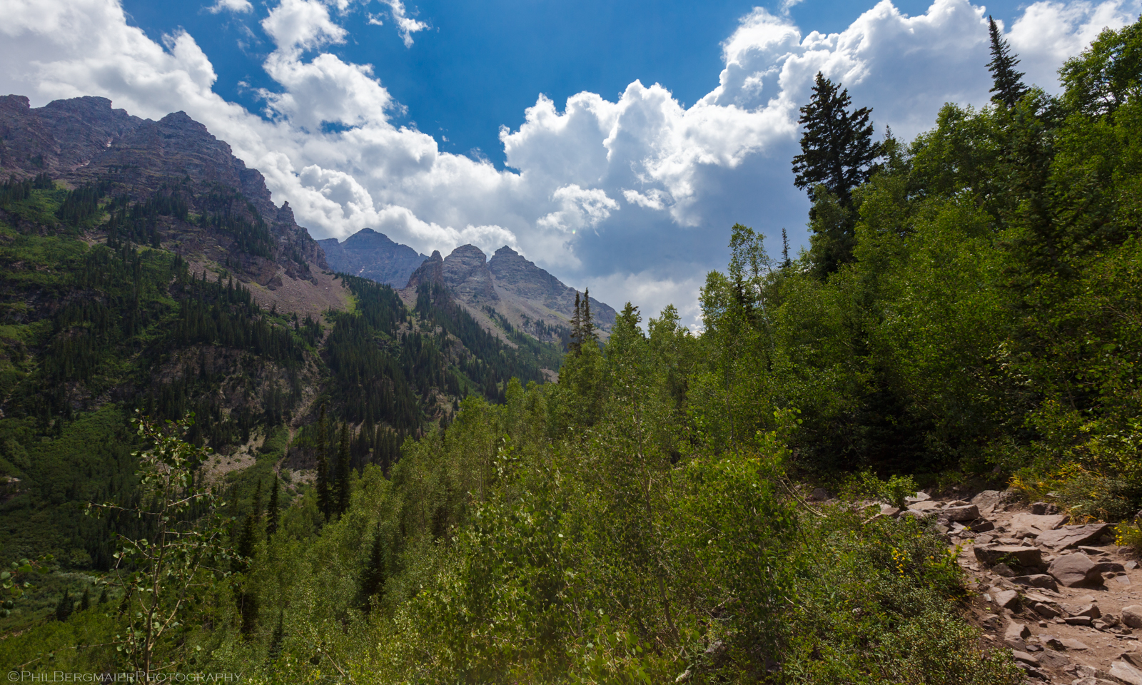
Photo 39 - Pyramid Peak from the main Maroon Lake Trail
At 1:50, we were back to the main Maroon Lake Trail. If you've ever been in that area during the day in the summer, you know that it gets incredibly touristy, especially on weekends. So, we went from seeing only a few other hikers on the trail to seeing dozens and dozens of regular folks and their kids just kinda enjoying their afternoon. It's really quite the contrast. It's a shame, too, that not many people wander off the main trail to explore! In my opinion, the best experiences (and views!) are when you get away from the crowds.
It is astonishing how much Pyramid Peak towers over the valley below (Photo 39). Such a great hike, perhaps my favorite of all the 14ers I've hiked/climbed so far. This was #37 for me, only 21 to go. The bad news is that 17 of those 21 are faaaaaar from my home, at least a 5-hr drive. Well, at least I should have plenty of time to get 'em.
We arrived back at the trailhead at 2:23 pm, making for a 4-hr descent and a 9.5-hr day overall! Rain clouds were building over the peaks by now, so it was wonderful to be back at the car. I'm sure I'll be back soon, if not to hike then to see the changing fall color in September. I'll end with the photo below overlooking Maroon Lake and the ominous clouds over the Bells! Thanks for reading!
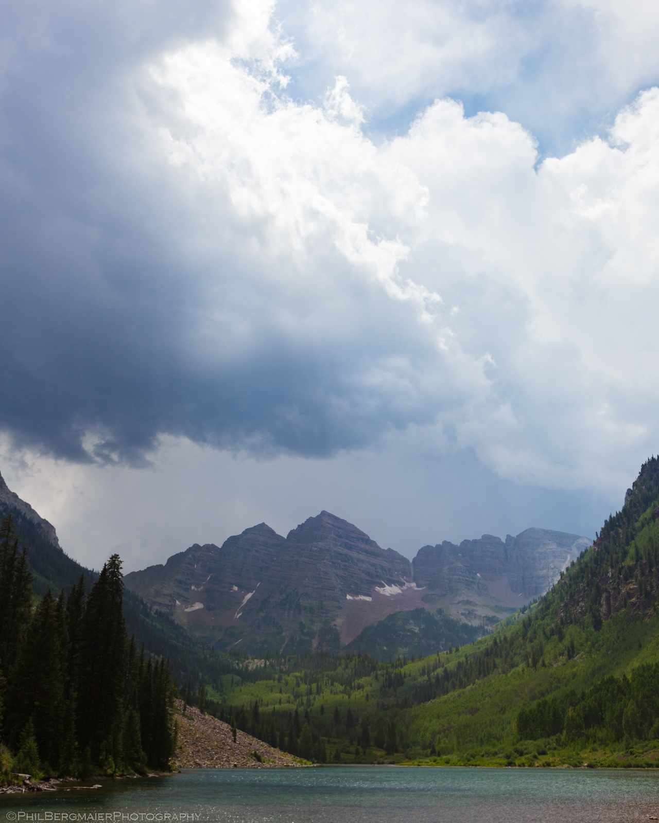
Photo 40 - The Maroon Bells from Maroon Lake
Thanks!! What a great, beautiful and fun report to read.